When were the borders of the countries of the World mapped?
Posted By RichC on February 22, 2023
Here is an impressive map of "The Age of the World’s Borders." (right-click and zoom in)
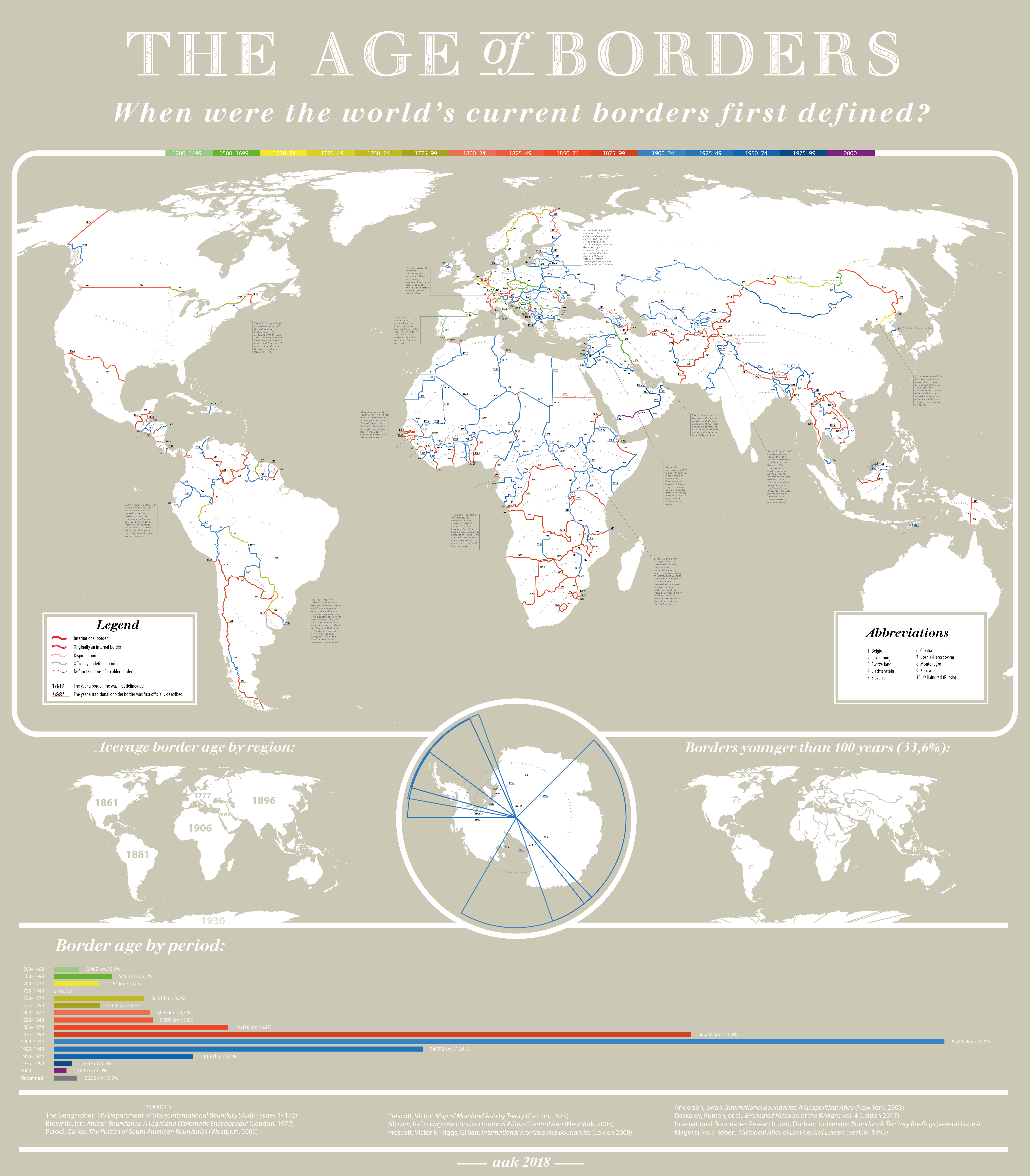
But when were most of the world’s borders formed? By time period they are:
- 1200-1499: 2,405km (0.9%)
- 1500-1699: 5,463km (2.1%)
- 1700-1724: 4,264km (1.6%)
- 1725-1749: 0km (0%)
- 1750-1774: 8,491km (3.3%)
- 1775-1799: 4,350km (1.7%)
- 1800-1824: 9,025km (3.5%)
- 1825-1849: 9,309km (3.6%)
- 1850-1874: 16,416km (6.4%)
- 1875-1899: 60,046km (23.6%)
- 1900-1924: 83,897km (32.9%)
- 1925-1949: 34,752km (13.6%)
- 1950-1974: 13,130km (5.1%)
- 1975-1999: 1,674km (0.6%)
- 2000-today: 1,189km (0.4%)
- Undefined: 2,202km (0.8%)
Therefore, 52.2% of the world’s borders were set during the 20th century and a further 37.1% were set during the 19th century.
Obviously a map like this is going to disputed, but PisseGuri82 has gone to great lengths to explain his methodology …
Comments