Pilot maps the 48 contiguous US and USA 250th in an Ohio flight
Posted By RichC on July 5, 2026
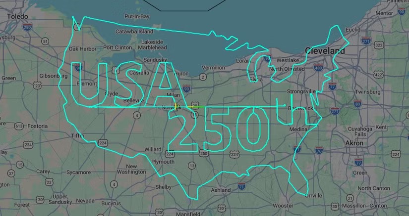
 With our nation’s 250th birthday plus one, here’s an Ohio oriented aviation story that was pretty cool. I’m not sure what kind of planning it took for the pilot to take his Cessna Skyline 182 RG to fly this kind of six hour “map drawing flight,” but it did take a few gallons of fuel (likely 70-80?) and a lot of precision flying.
The Cessna celebrated America’s upcoming semiquincentennial with a six-hour journey from Norwalk, where the Cessna 182 etched its own unique flight map in the skies between Toledo in the west and Cleveland in the east. For the pilot, the flight preparation must have taken some time to ensure the flight path followed would exactly outline the map of the contiguous United States, including all its bordering lakes and peninsulas, and panhandles, while including the words ‘USA 250th’ in its interior.
Thanks for forwarding the story, Drew … and yes Katelyn, it is “bloggable.” 😉
Comments