As a big fan of “maps,” this on weather in Canada is a good one
Posted By RichC on March 28, 2025
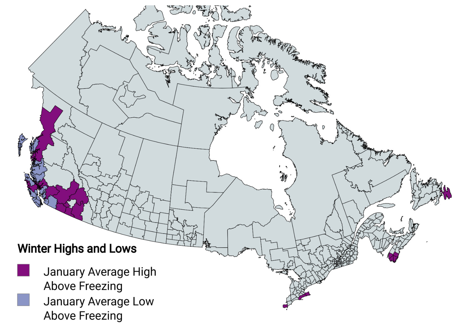
An interesting map on BrilliantMaps.com (from a Reddit post), highlights Canada’s January temperature patterns, showing where average highs and lows rise above freezing. The West Coast, particularly around Vancouver and Victoria, and parts of Nova Scotia, like Halifax, are marked in purple, indicating January average highs above 0°C (32°F). These areas, influenced by the Pacific and Atlantic Oceans, enjoy milder winters with highs of 6-8°C in Vancouver and 0-2°C in Halifax, often seeing rain rather than snow. Light blue spots in these regions also show average  lows above freezing, making winter more manageable compared to the rest of the country.
The unshaded majority of Canada, however, experiences a true deep freeze (image left created by Grok AI), with both average highs and lows below 0°C. In places like Winnipeg, January highs average -13°C (9°F), while lows can drop to -23°C (-10°F) or colder in the northern territories. This map underscores Canada’s climatic diversity—whether you’re in a milder coastal city or the frigid interior, winter shapes life differently.


 (
(